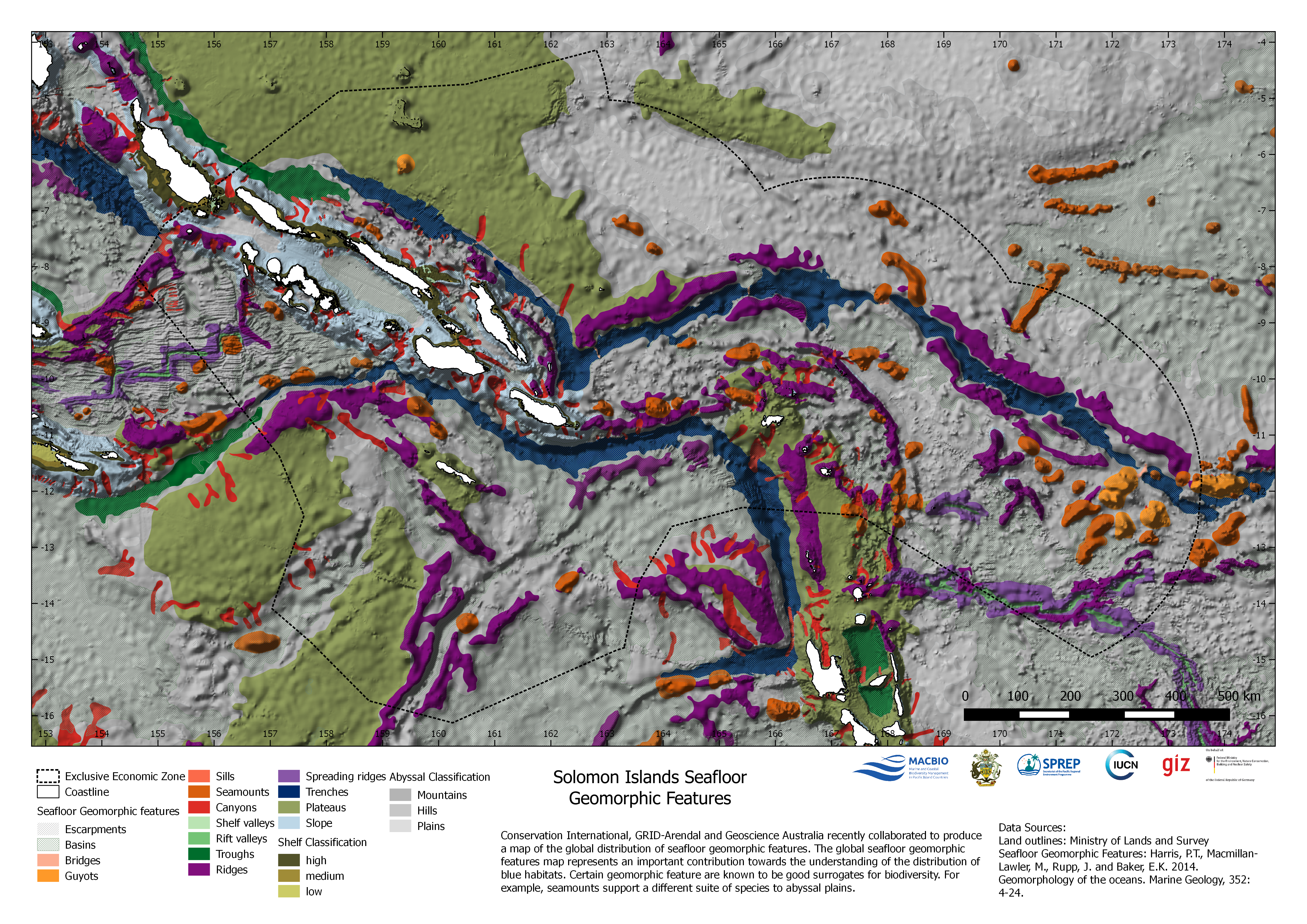
This maps shows the geomorphic features of the…
License
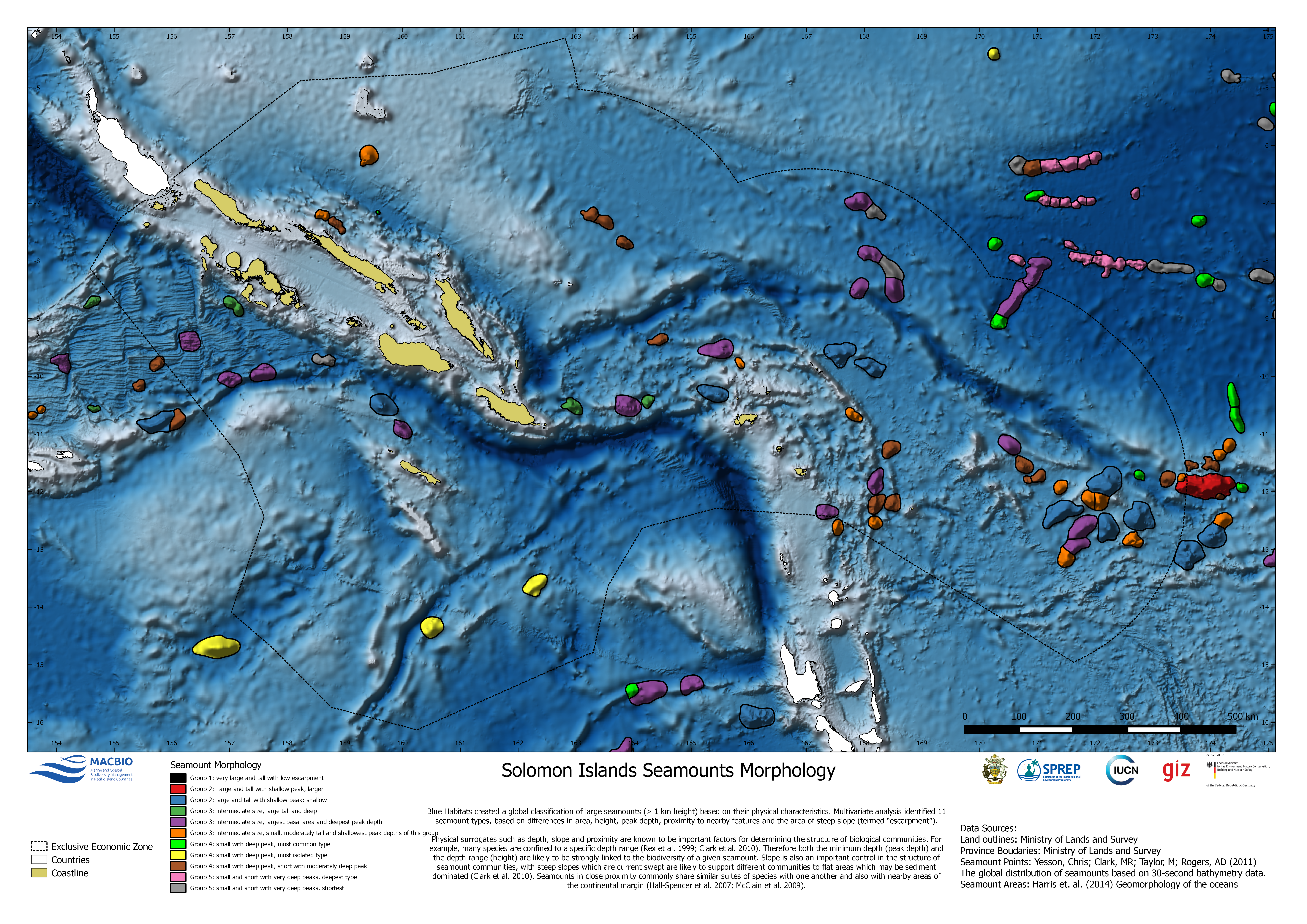
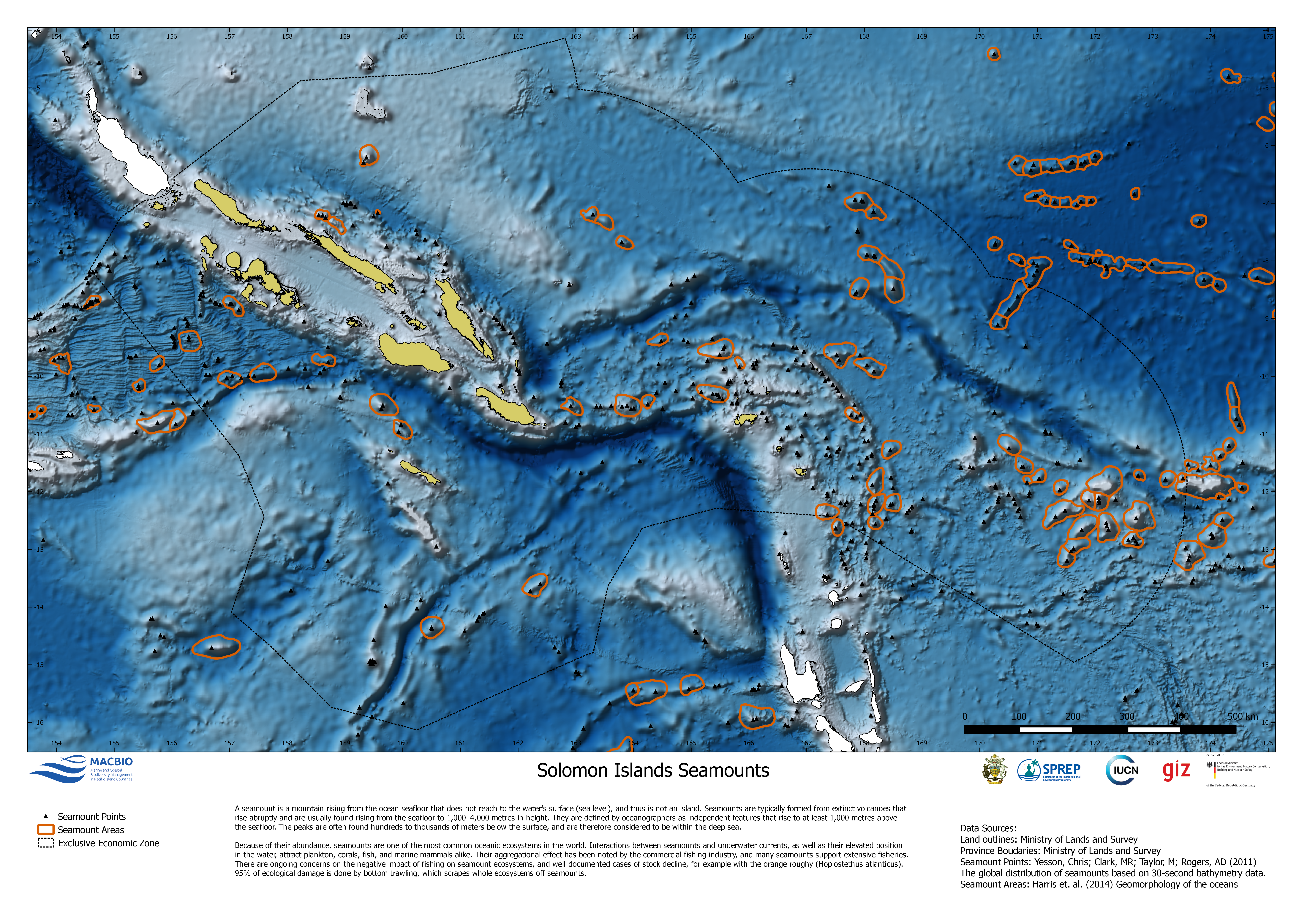
Maps showing geomorphic features. The maps were developed by MACBIO as resources for the bioregions workshops in Feb 2018.
Data and Resource
| Field | Value |
|---|---|
| Publisher | Solomon Islands Ministry of Environment, Climate Change, Disaster Management and Meteorology |
| Modified | |
| Release Date | |
| Source URL | https://solomonislands-data.sprep.org/dataset/seafloor-geomorphology |
| Identifier | 0954d9c6-1955-41c1-b2fa-16579d11216e |
| Spatial / Geographical Coverage Location | Solomon Islands |
| Relevant Countries | Solomon Islands |
| Language | English (Australia) |
| License |
Public
![[Open Data]](https://assets.okfn.org/images/ok_buttons/od_80x15_blue.png)
|
| Contact Name | Anja Nicolay-Grosse Hokamp |
| Contact Email | [email protected] |
| POD Theme | Coastal and Marine |