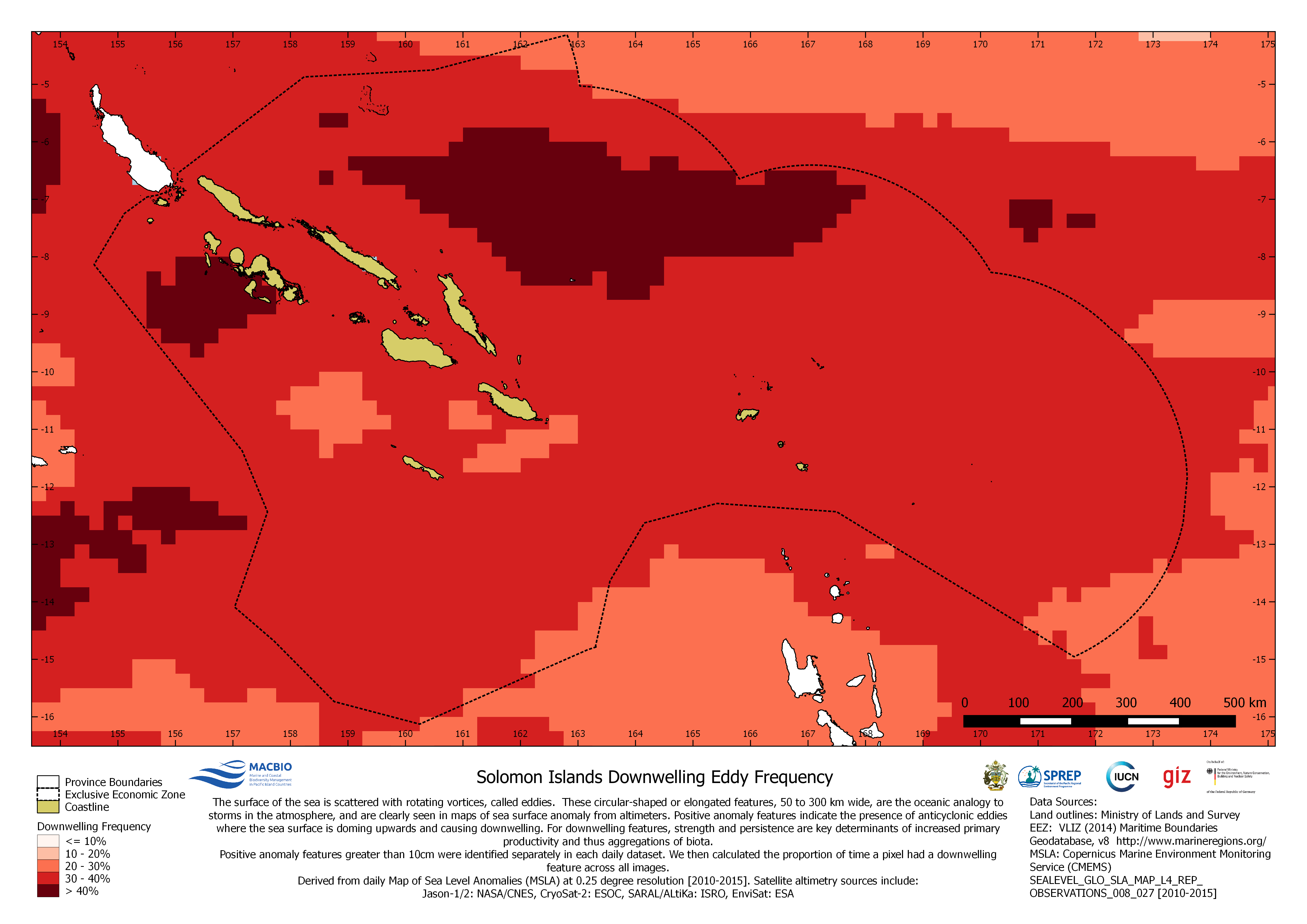
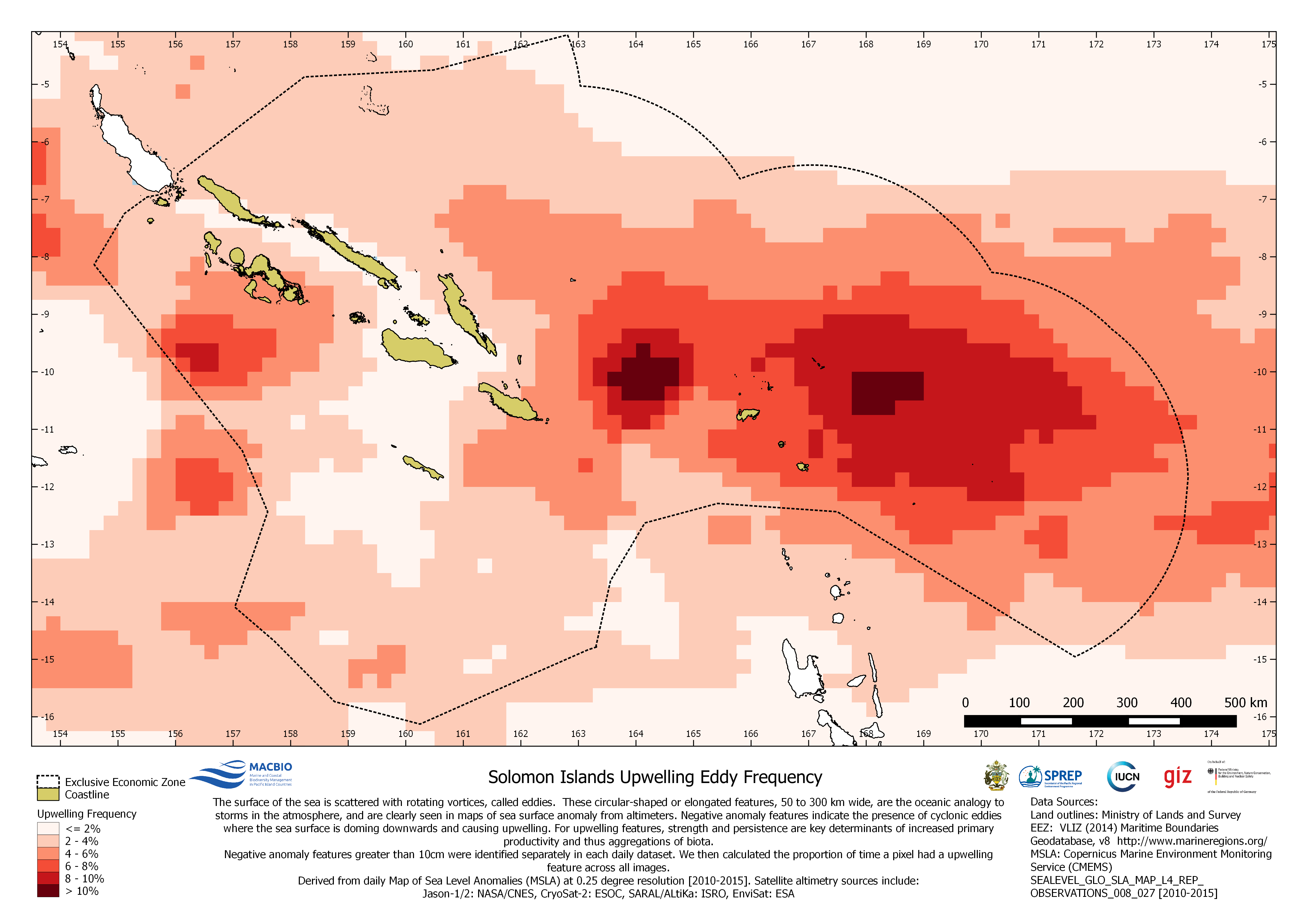
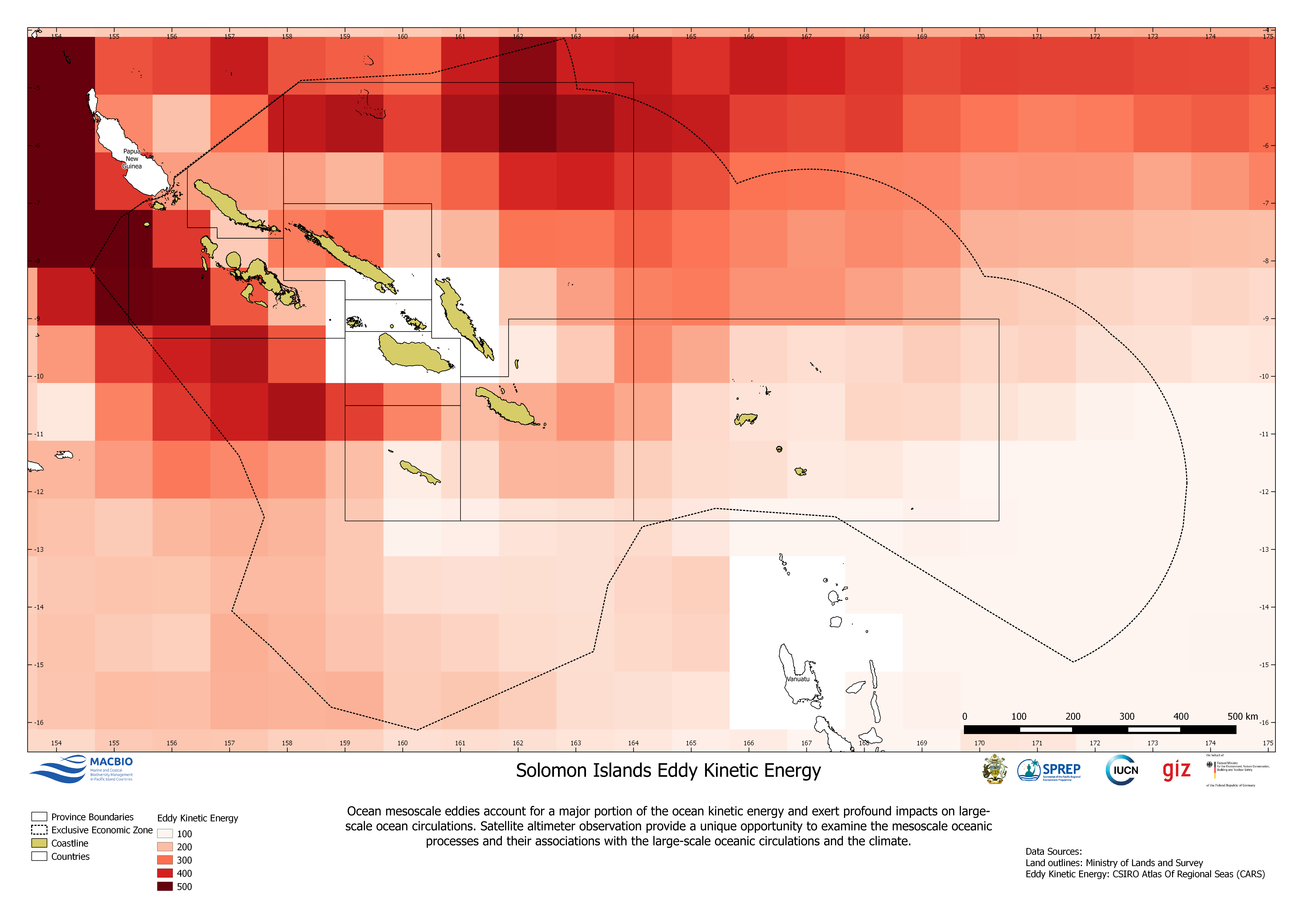
Eddies are circular shaped or elongated…
License
A map showing down-welling eddy frequency in Solomon Islands EEZ. The map was created by MACBIO as resource for the bioregions workshop in Feb 2018. Data is based on Copernicus Marine Environment Monitoring Service (CMEMS).
Data and Resource
| Field | Value |
|---|---|
| Publisher | Solomon Islands Ministry of Environment, Climate Change, Disaster Management and Meteorology |
| Modified | |
| Release Date | |
| Source URL | https://solomonislands-data.sprep.org/dataset/solomon-islands-eddy-maps |
| Identifier | 2d3a681d-1069-4894-ab38-0fec33931d69 |
| Spatial / Geographical Coverage Location | Solomon Islands |
| Relevant Countries | Solomon Islands |
| Language | English (Australia) |
| License |
Public
![[Open Data]](https://assets.okfn.org/images/ok_buttons/od_80x15_blue.png)
|
| Contact Name | Anja Nicolay-Grosse Hokamp |
| Contact Email | [email protected] |
| POD Theme | Coastal and Marine |