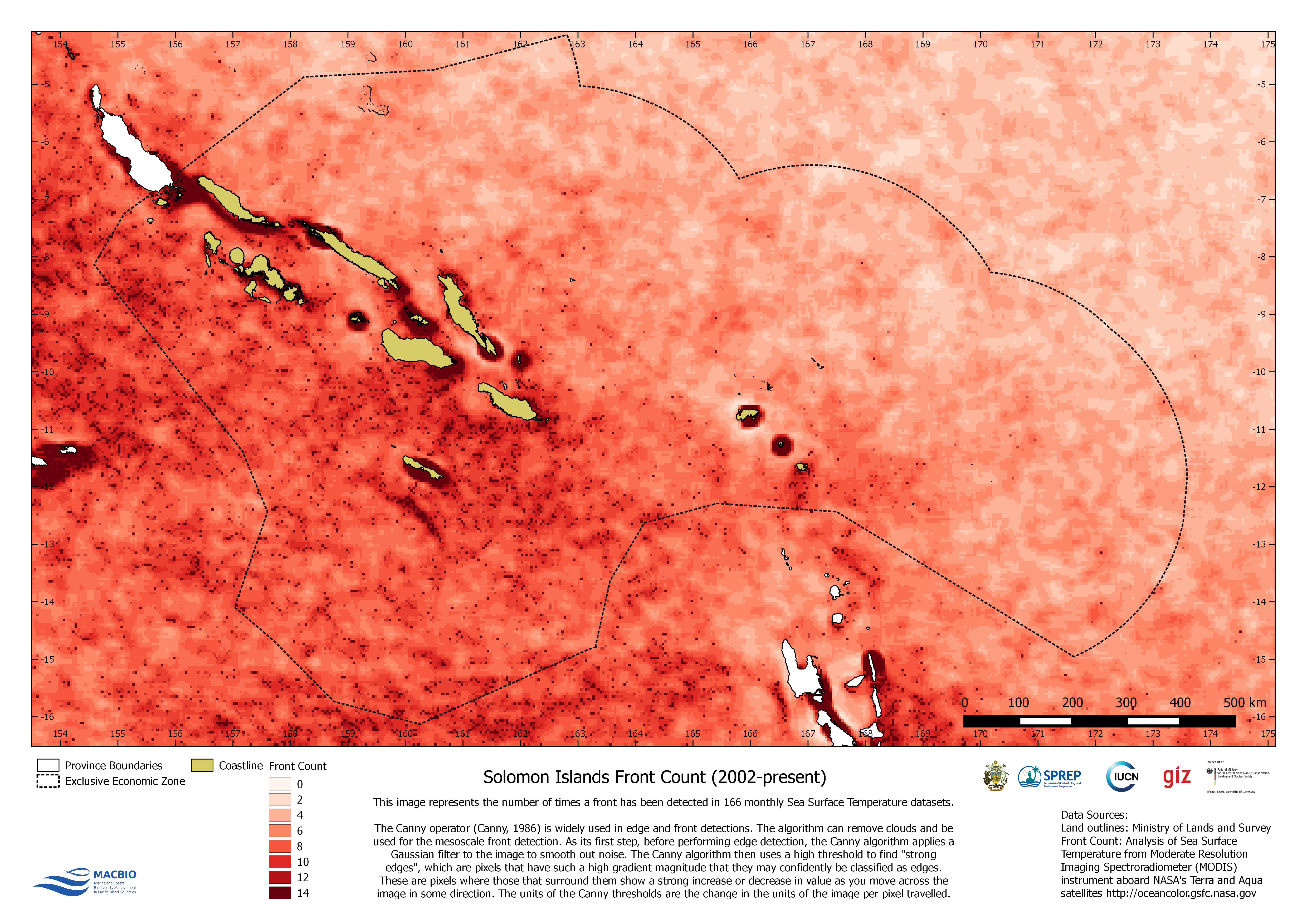
This image represents the number of times a…
License
This map was created by MACBIO as resource for the bioregions workshop in Feb 2018. The map represents the number of times a front has been detected in Sea Surface Temperature. Data is based on Moderate Resolution Imaging Spectroradiometer (MODIS).
| Field | Value |
|---|---|
| Publisher | Solomon Islands Ministry of Environment, Climate Change, Disaster Management and Meteorology |
| Modified | |
| Release Date | |
| Source URL | https://solomonislands-data.sprep.org/dataset/solomon-islands-front-count-2002-… |
| Identifier | e472c30f-83cf-4ceb-866a-81dda0fcf954 |
| Spatial / Geographical Coverage Location | Solomon Islands |
| Relevant Countries | Solomon Islands |
| Language | English (Australia) |
| License |
Public
![[Open Data]](https://assets.okfn.org/images/ok_buttons/od_80x15_blue.png)
|
| Contact Name | Anja Nicolay-Grosse Hokamp |
| Contact Email | [email protected] |
| POD Theme | Coastal and Marine |