This map was developed by MACBIO as resource…
License
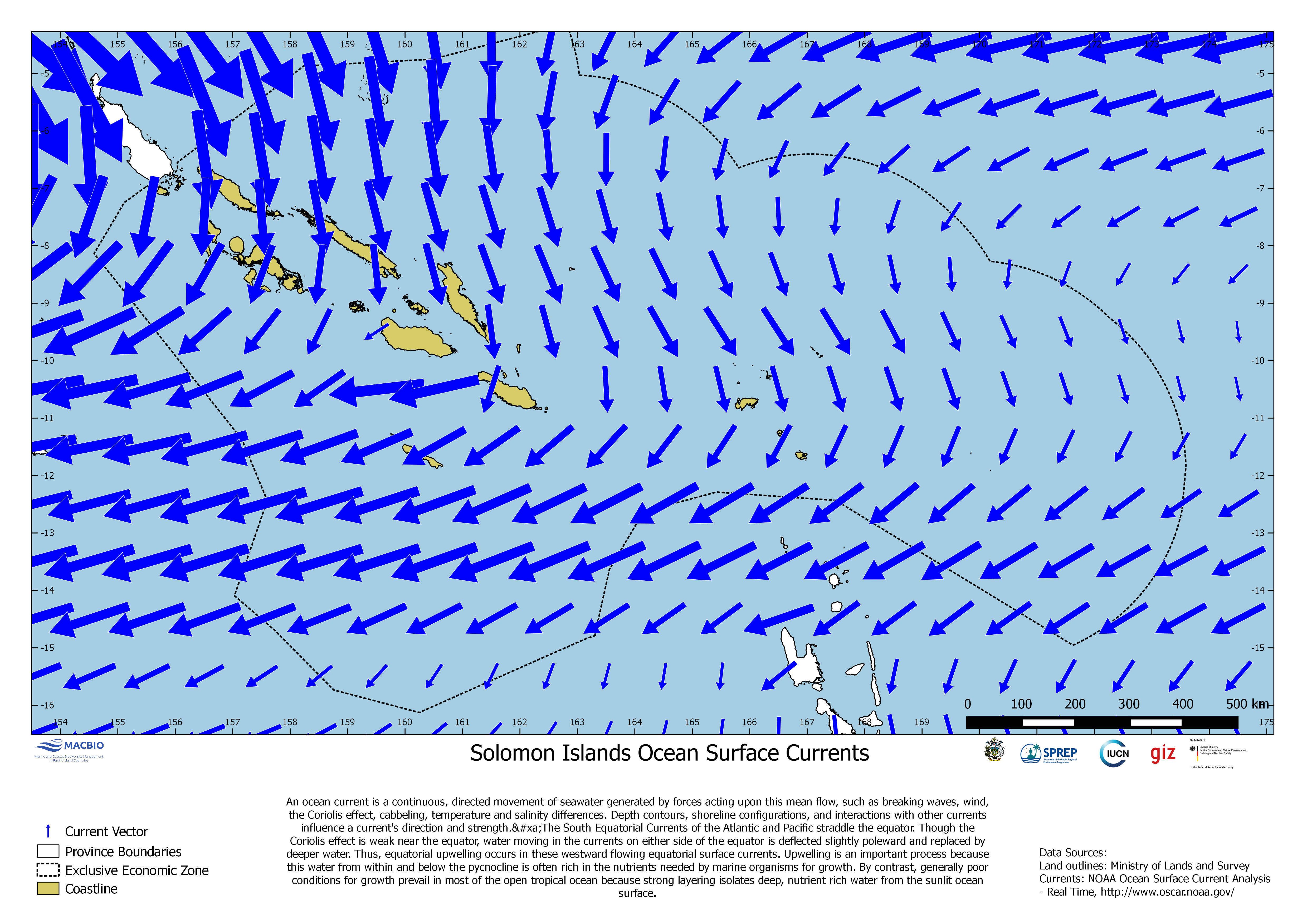
This map was developed by MACBIO as resource for the bioregions workshop 2017 and shows ocean surface currents based on data from NOAA Ocean Surface Current Analysis (http://www.oscar,noaa.gov/).
| Field | Value |
|---|---|
| Publisher | Solomon Islands Ministry of Environment, Climate Change, Disaster Management and Meteorology |
| Modified | |
| Release Date | |
| Source URL | https://solomonislands-data.sprep.org/dataset/solomon-islands-ocean-surface-cur… |
| Identifier | e0e53381-5d8e-4270-aea7-17800d8e18a1 |
| Spatial / Geographical Coverage Location | Solomon Islands |
| Relevant Countries | Solomon Islands |
| Language | English (Australia) |
| License |
Public
![[Open Data]](https://assets.okfn.org/images/ok_buttons/od_80x15_blue.png)
|
| Contact Name | Anja Nicolay-Grosse Hokamp |
| Contact Email | [email protected] |
| POD Theme | Coastal and Marine |