Map with 1-degree resolution of observations…
License
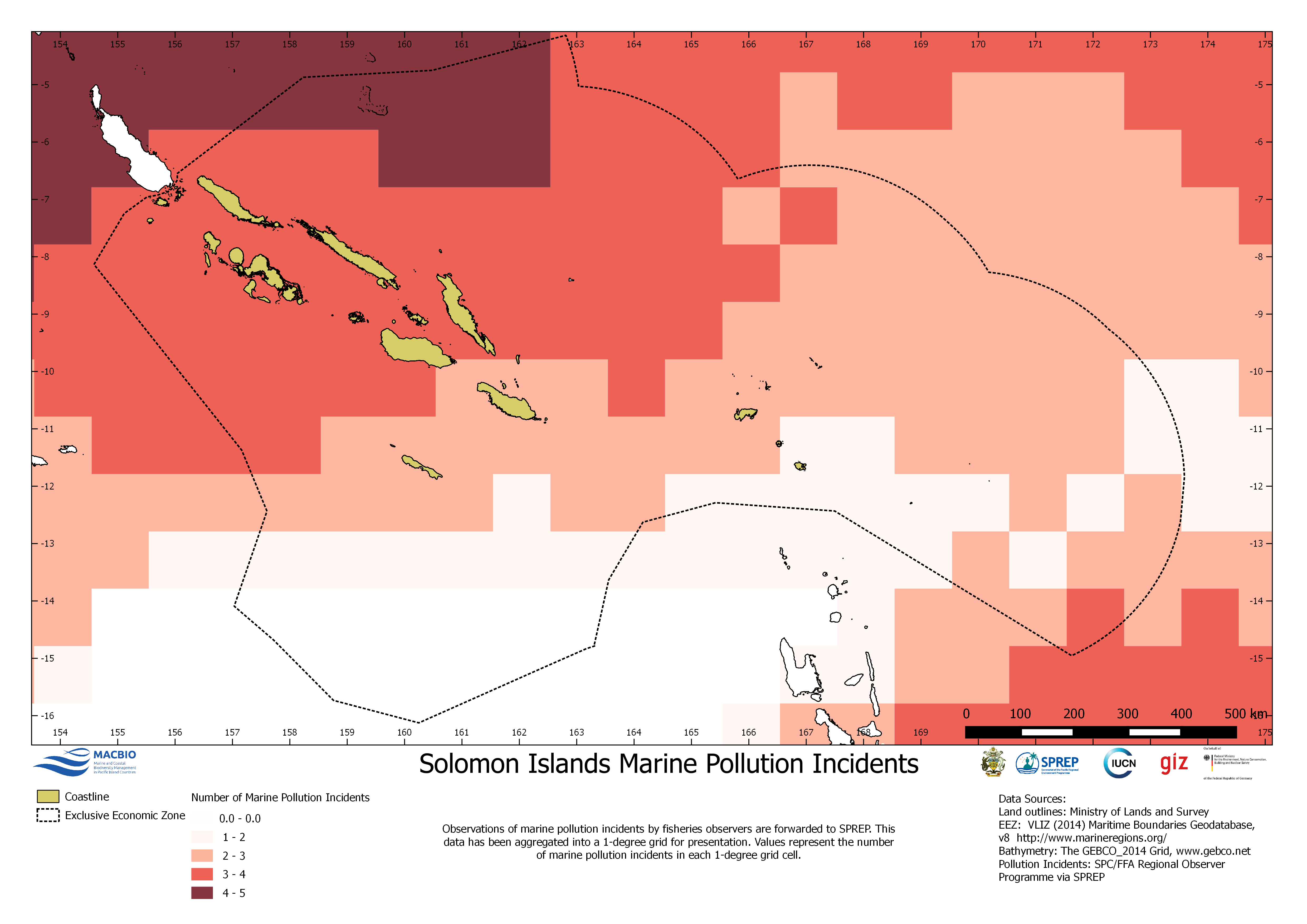
Map of marine pollution incidents by fisheries observer. Resolution 1 degree grid. Resource Map developed by MACBIO for bioregions workshop in Feb 2018.
| Field | Value |
|---|---|
| Publisher | Solomon Islands Ministry of Environment, Climate Change, Disaster Management and Meteorology |
| Modified | |
| Release Date | |
| Source URL | https://solomonislands-data.sprep.org/dataset/solomon-islands-marine-pollution-… |
| Identifier | 8b5fecb2-6f12-458e-b336-c754e1df321b |
| Spatial / Geographical Coverage Location | Solomon Islands |
| Relevant Countries | Solomon Islands |
| Language | English (Australia) |
| License |
Public
![[Open Data]](https://assets.okfn.org/images/ok_buttons/od_80x15_blue.png)
|
| Contact Name | Anja Nicolay-Grosse Hokamp |
| Contact Email | [email protected] |
| POD Theme | Coastal and Marine |