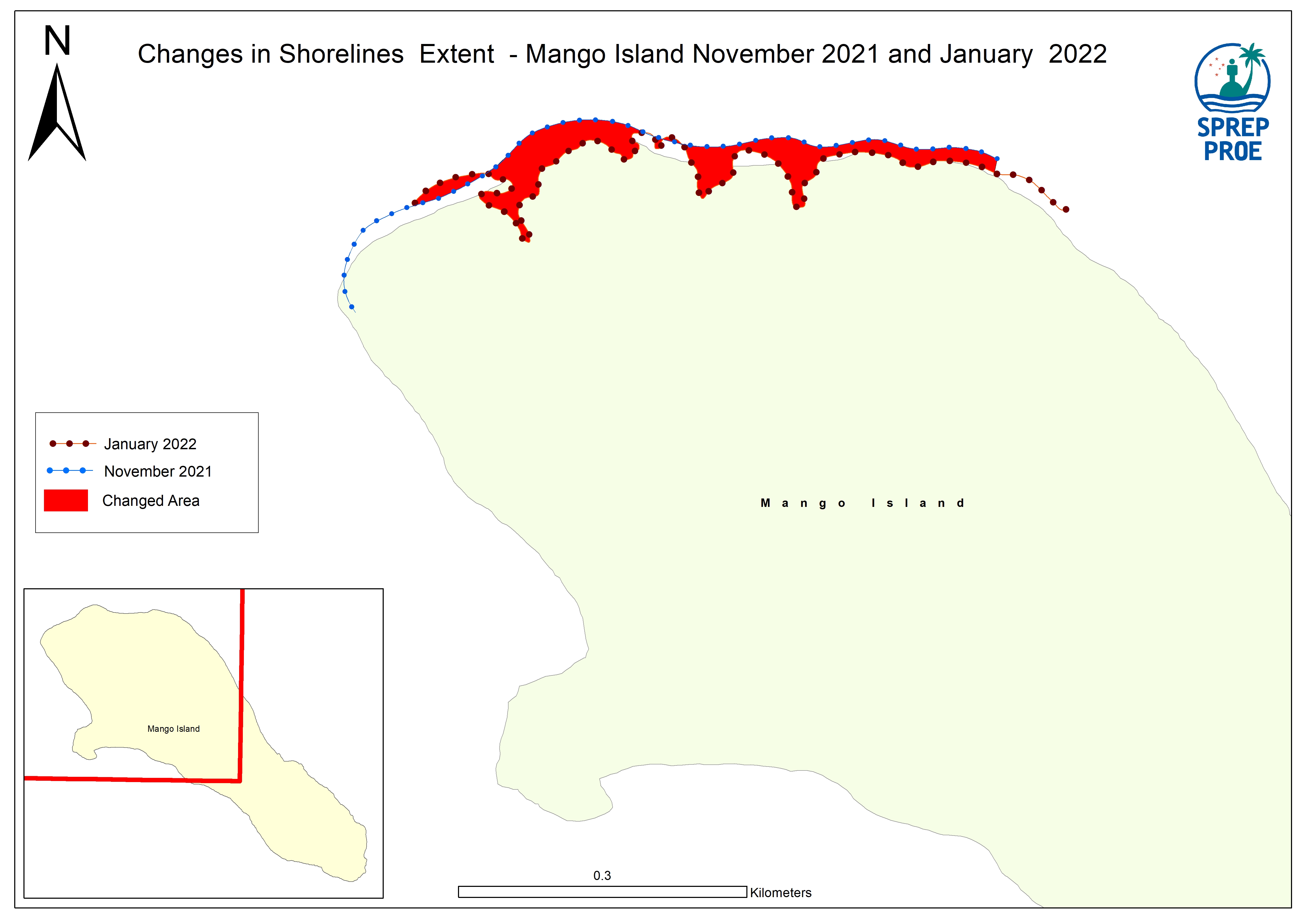
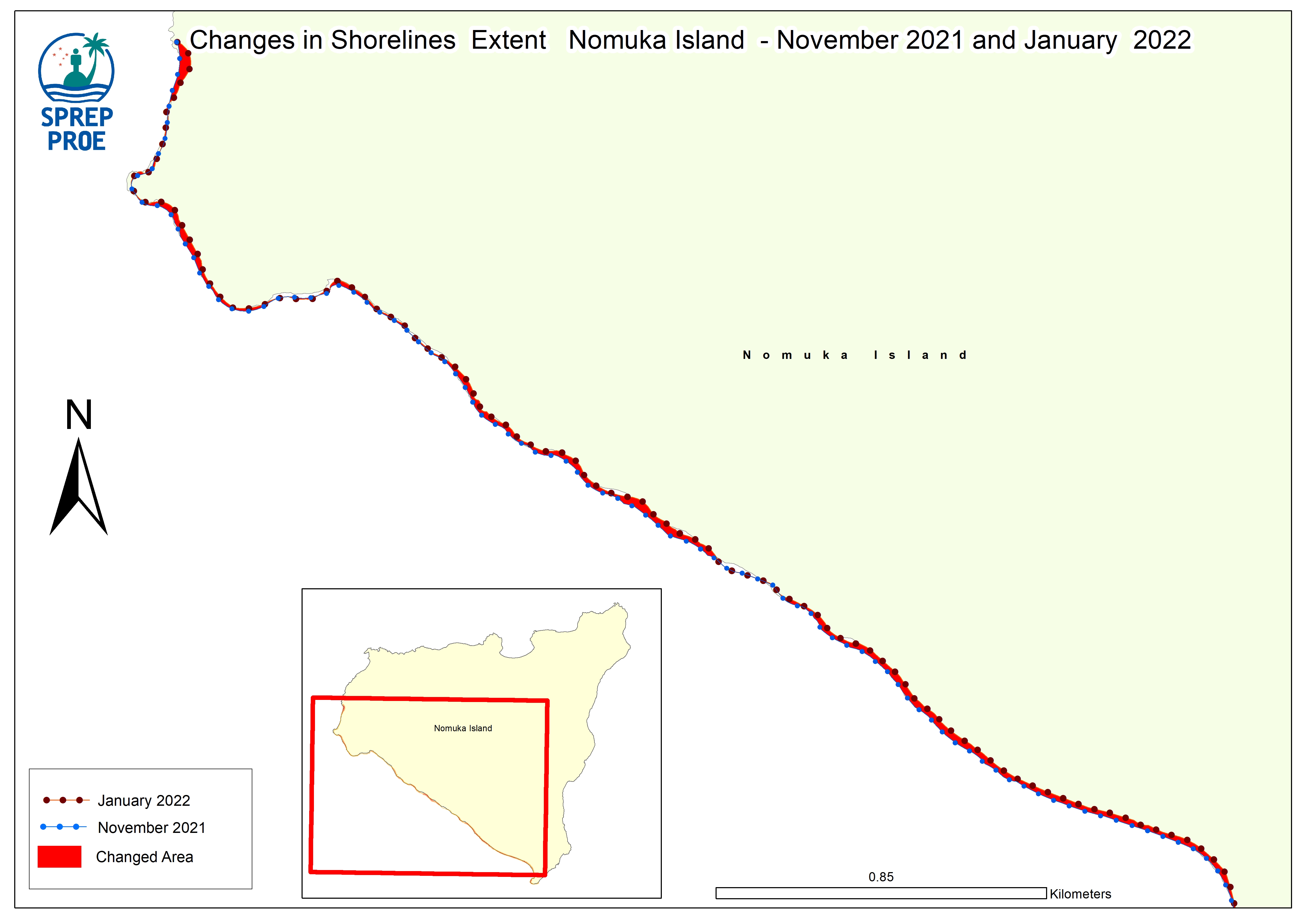
This map illustrates the impact of the Hunga…
This dataset contains all spatial data that is related to the Tonga volcanic eruption. Maps produced are derived from credible data source such as UNOSTAT and UNITAR.

Data and Resource
pdf
Emergency Response Coordination (ERCC) - DG ECHO Daily Map | 20/01/2022 - Volcanic Eruption and Tsunami Tonga
The map was produced by JRC.. Joint Research…
zip
Impact from Eruption and Ash Deposits on Tonga Reefs Map
Map showing reefs with in the different…
| Field | Value |
|---|---|
| Publisher | SPREP |
| Modified | |
| Release Date | |
| Source URL | https://tonga-data.sprep.org/dataset/spatial-data-hunga-tonga-hunga-haapai-volc… |
| Identifier | ec0d53aa-2ff4-496c-82c4-3730c4b63499 |
| Spatial / Geographical Coverage Location | Tonga |
| Relevant Countries | Tonga |
| Language | English |
| License |
Public
![[Open Data]](https://assets.okfn.org/images/ok_buttons/od_80x15_blue.png)
|
| Contact Name | tonga@dmin |
| POD Theme | Built Environment, Atmosphere and Climate, Coastal and Marine |