Map showing the location and maximum wave…
License
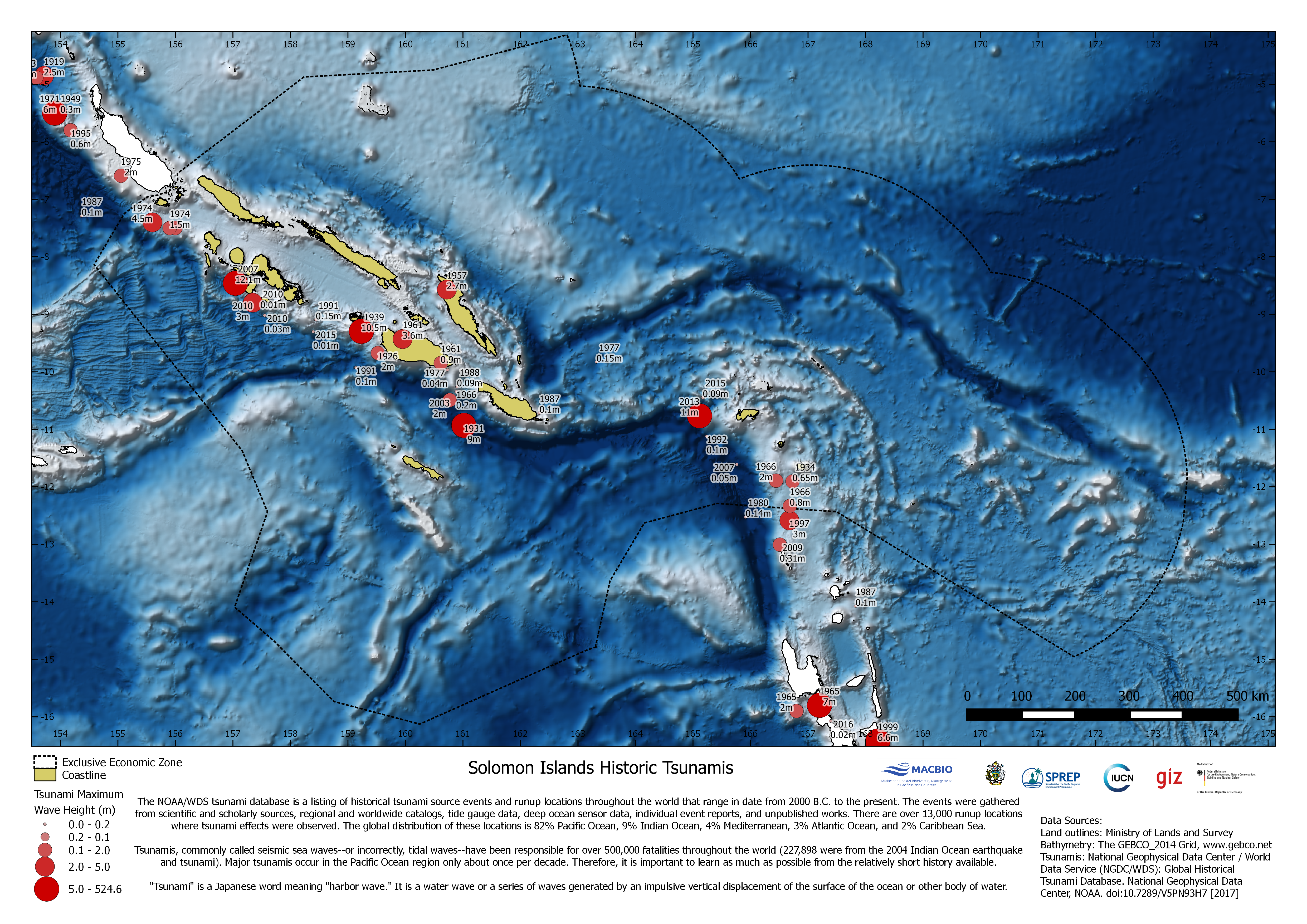
Map showing location and wave height of historic Tsunami events from 2000B.C. to the present. The map was compiled by MACBIO as resource for the bioregions workshop in Feb 2018. Data is based on National Geophysical Data Center, NOAA.
| Field | Value |
|---|---|
| Publisher | Solomon Islands Ministry of Environment, Climate Change, Disaster Management and Meteorology |
| Modified | |
| Release Date | |
| Source URL | https://solomonislands-data.sprep.org/dataset/solomon-islands-historic-tsunamis |
| Identifier | 9f3941ae-c954-4904-a9fc-b2711f880340 |
| Spatial / Geographical Coverage Location | Solomon Islands |
| Relevant Countries | Solomon Islands |
| Language | English (Australia) |
| License |
SPREP Public Licence
![[Open Data]](https://assets.okfn.org/images/ok_buttons/od_80x15_blue.png)
|
| Contact Name | Anja Nicolay-Grosse Hokamp |
| Contact Email | [email protected] |
| POD Theme | Coastal and Marine |