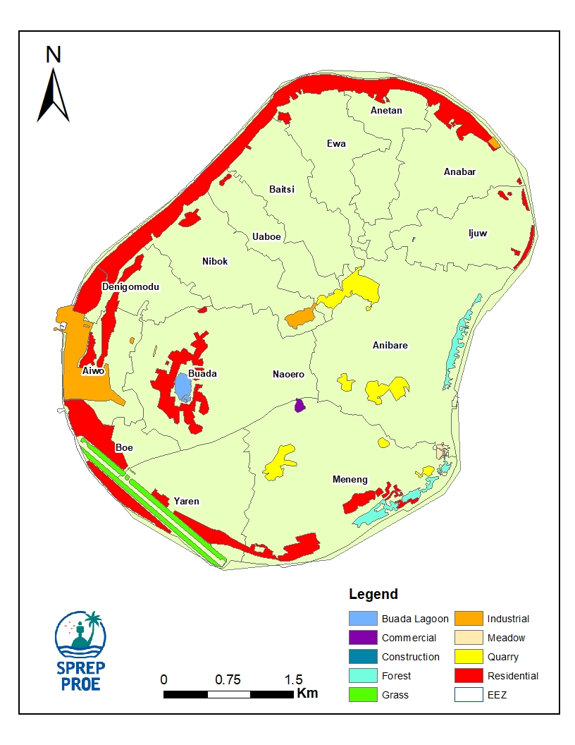
The map shows the different landcover classes…
Map of the Nauru Island landuse, with country-level summary of the different landuse classes and designation.
Data and Resource
| Field | Value |
|---|---|
| Publisher | Nauru Department of Commerce, Industry and Environment |
| Modified | |
| Release Date | |
| Source URL | https://nauru-data.sprep.org/dataset/nauru-landuse-map |
| Identifier | 24cb1eb2-7ce8-460f-8dc5-ef7764ddf29a |
| Spatial / Geographical Coverage Location | Nauru |
| Relevant Countries | Nauru |
| Language | English (Canada) |
| License |
SPREP Public Licence
![[Open Data]](https://assets.okfn.org/images/ok_buttons/od_80x15_blue.png)
|
| Contact Name | Vani Koroisamanunu |
| Contact Email | [email protected] |
| POD Theme | Land, Built Environment |