The map shows the diffuse attenuation…
License
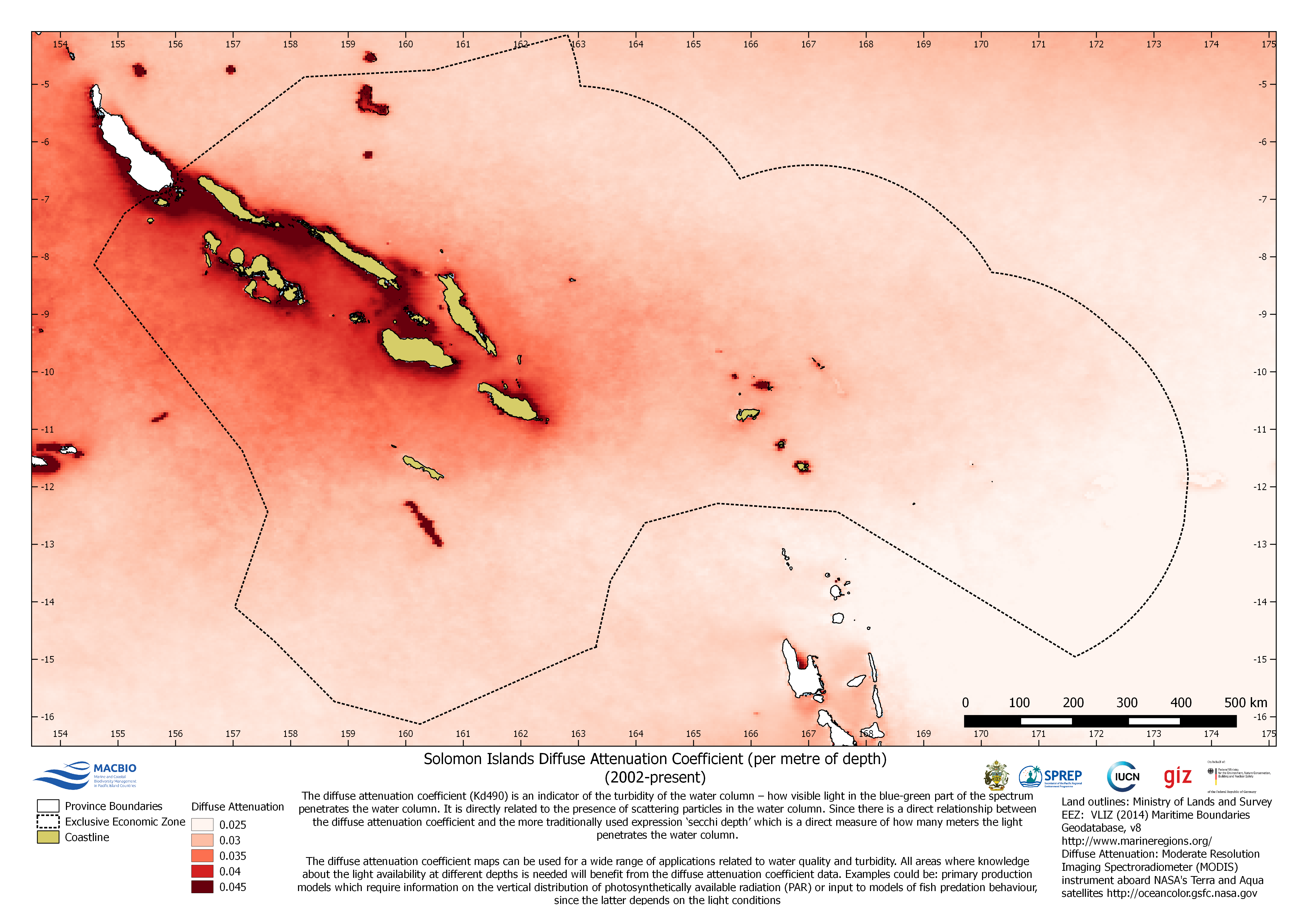
The map shows the diffuse attenuation coefficient per metre of depth (2002-present). This is an indicator of turbidity in the water column. The map was developed by MACBIO as resource for the bioregions workshop in Feb 2018.
| Field | Value |
|---|---|
| Publisher | Solomon Islands Ministry of Environment, Climate Change, Disaster Management and Meteorology |
| Modified | |
| Release Date | |
| Source URL | https://solomonislands-data.sprep.org/dataset/solomon-islands-diffuse-attenuati… |
| Identifier | 60ef8da0-3309-4338-be85-ac2e92190ced |
| Spatial / Geographical Coverage Location | Solomon Islands |
| Relevant Countries | Solomon Islands |
| Language | English (Australia) |
| License |
SPREP Public Licence
![[Open Data]](https://assets.okfn.org/images/ok_buttons/od_80x15_blue.png)
|
| Contact Name | Anja Nicolay-Grosse Hokamp |
| Contact Email | [email protected] |
| POD Theme | Coastal and Marine |