Primary tabs
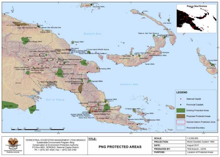
Map of Protected Areas in PNG (2017)
Map with existing and proposed protected areas in PNG. Status on August 2017. Produced by CEPA.
PNG_PA.JPG
(66.96 KB)
Additonal Information
| Field | Value |
|---|---|
| mimetype | image/jpeg |
| filesize | 66.96 KB |
| timestamp | Thu, 02/20/2025 - 13:00 |
| Source URL | https://www.sprep.org |