Primary tabs
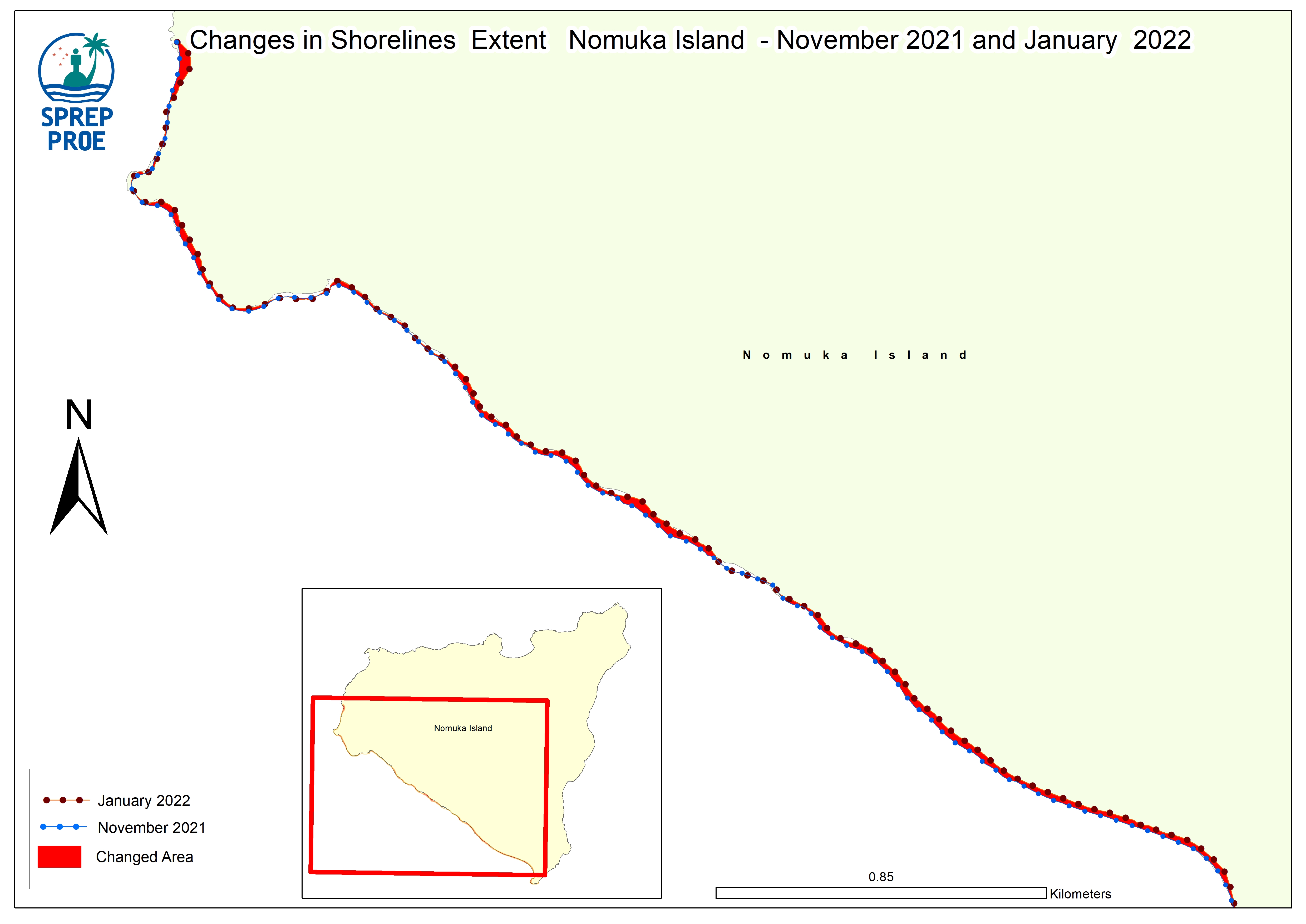
Shoreline Change Map Nomuka Island
The maps highlights areas with significant shift in the shoreline by overlaying shoreline data from Nov 2021 and January 2022
Shoreline%20Analysis%20Nomuka.jpg
(1.3 MB)
Additonal Information
| Field | Value |
|---|---|
| mimetype | image/jpeg |
| filesize | 1.3 MB |
| timestamp | Fri, 02/21/2025 - 13:00 |
| Source URL | https://tonga-data.sprep.org/dataset/spatial-data-hunga-tonga-hunga-haapai-volcanic-eruption |