Primary tabs
Solomon Islands Longline Tuna Catch
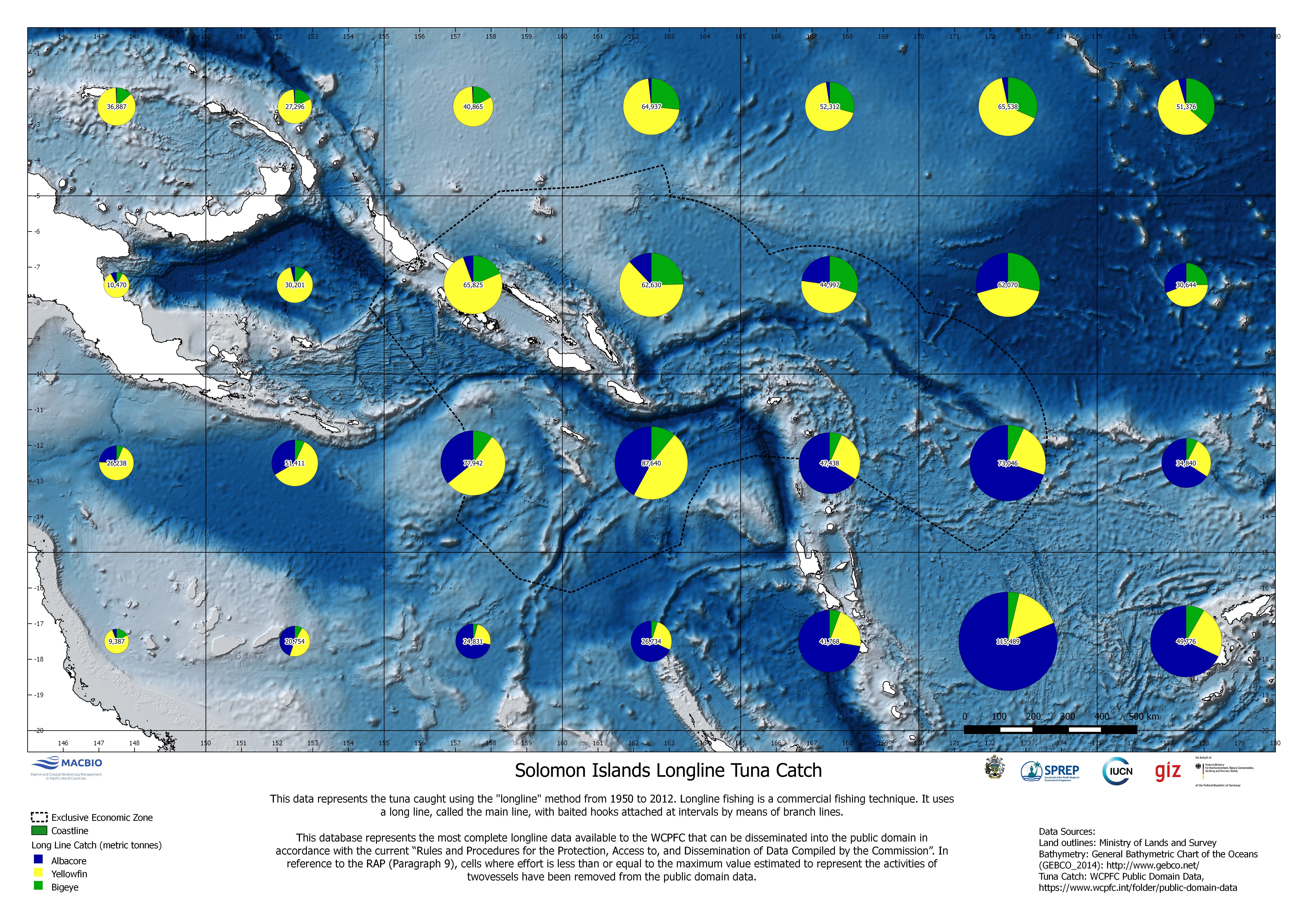
Map data represents the tuna catch using the "longline" method from 1950-2012. Longline fishing is a commercial fishing technique. The map was developed by MACBIO as resource for the bioregions workshop in Feb 2018. Data is based on WCPFC Public Domain Data.
SI_WCPFC_LongLine_EEZ.png
(26.39 MB)
Additonal Information
| Field | Value |
|---|---|
| mimetype | image/png |
| filesize | 26.39 MB |
| timestamp | Fri, 02/21/2025 - 13:00 |
| Source URL | https://solomonislands-data.sprep.org/dataset/tuna-catch-data-maps |